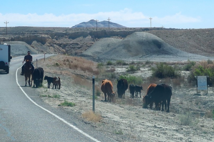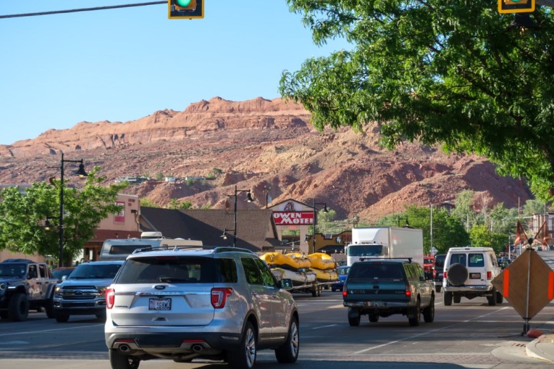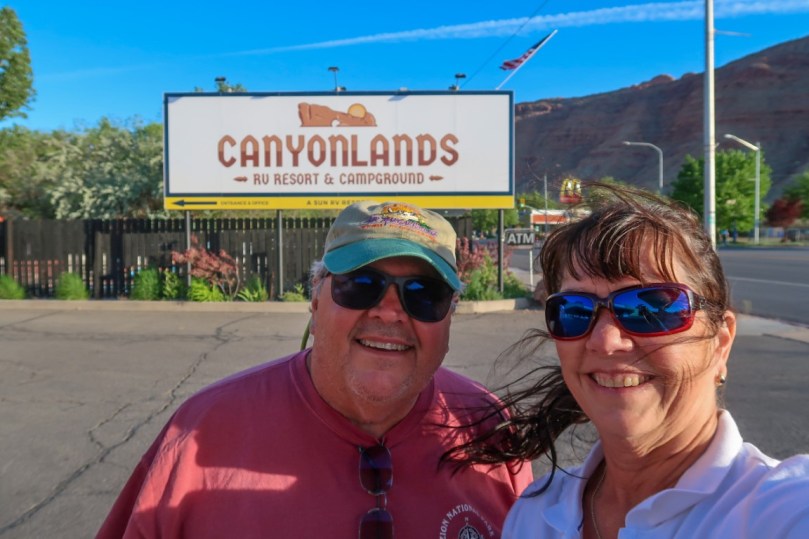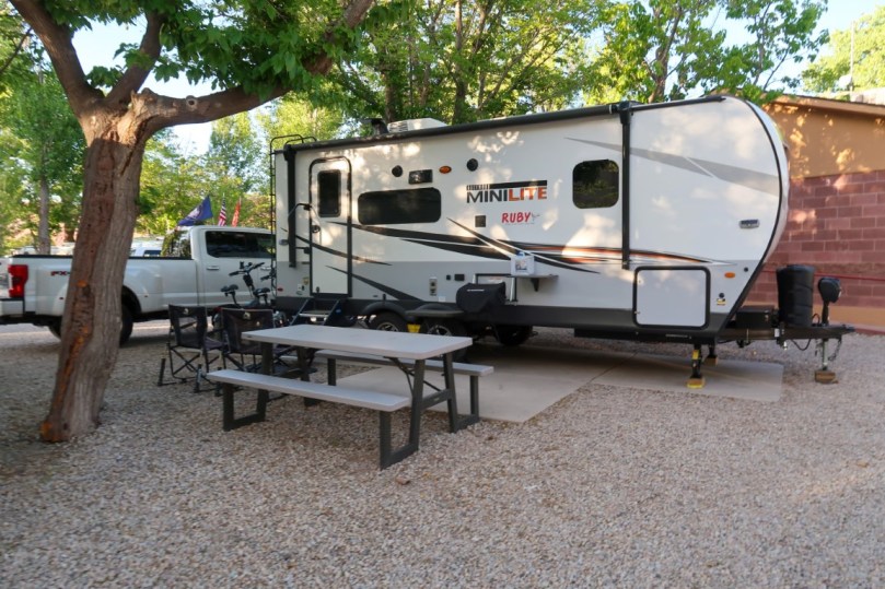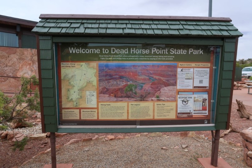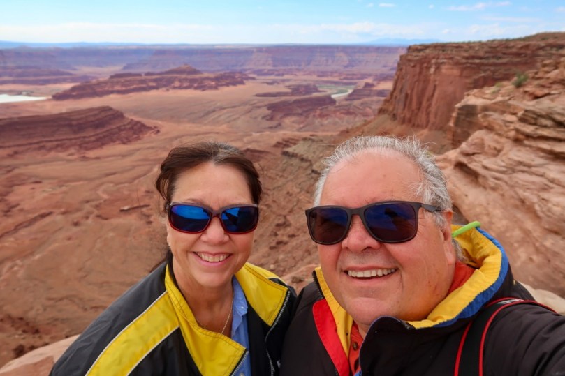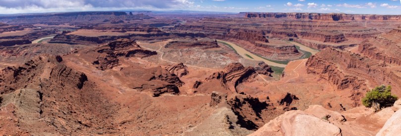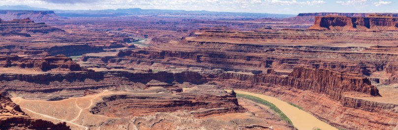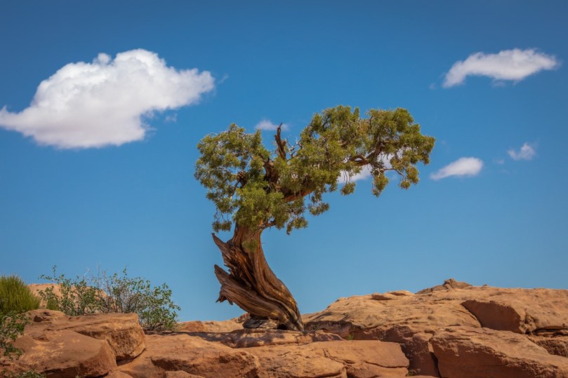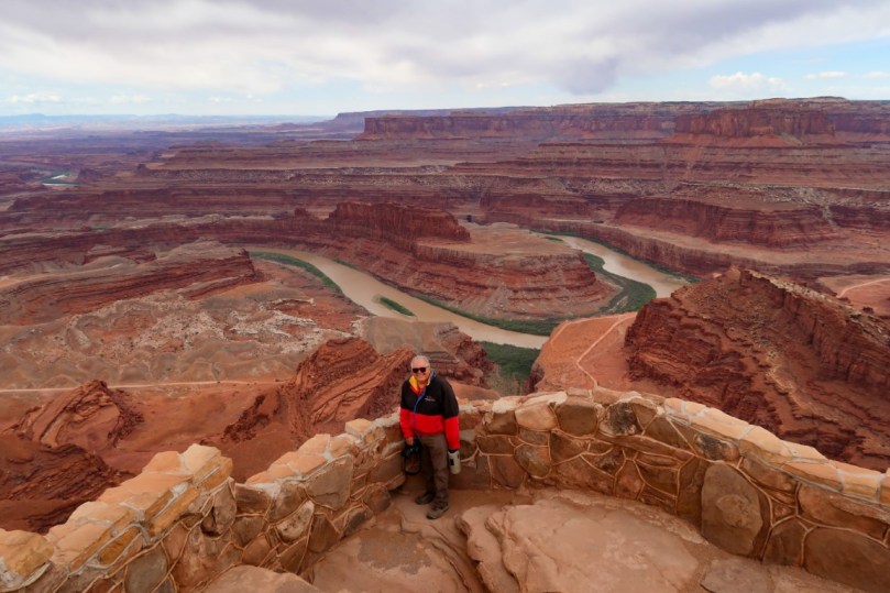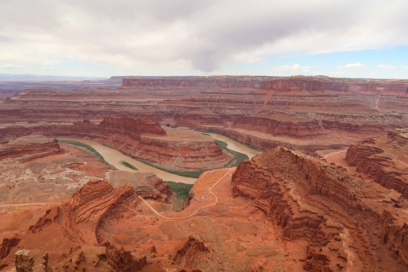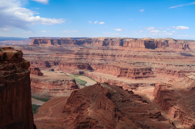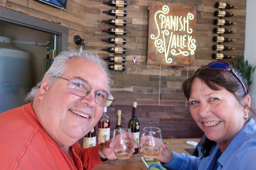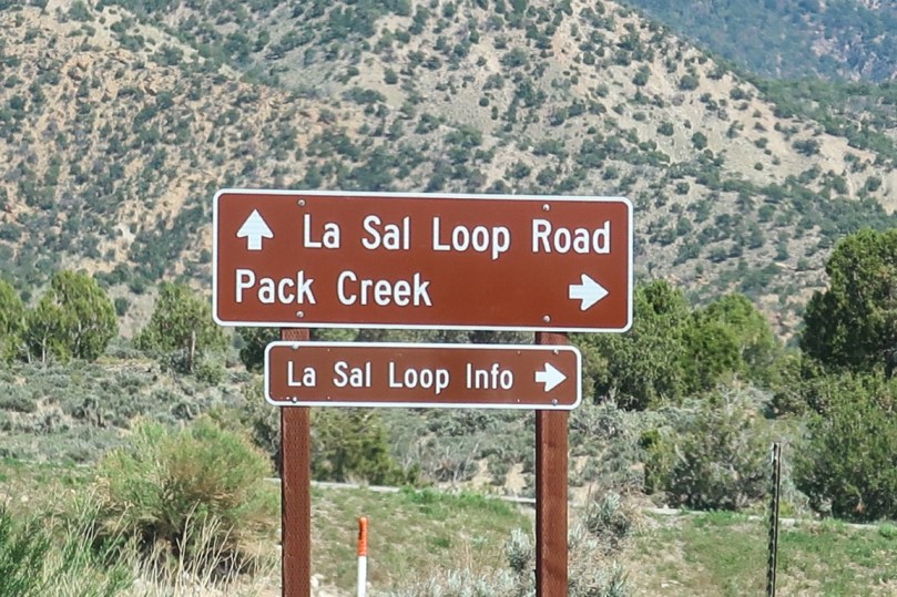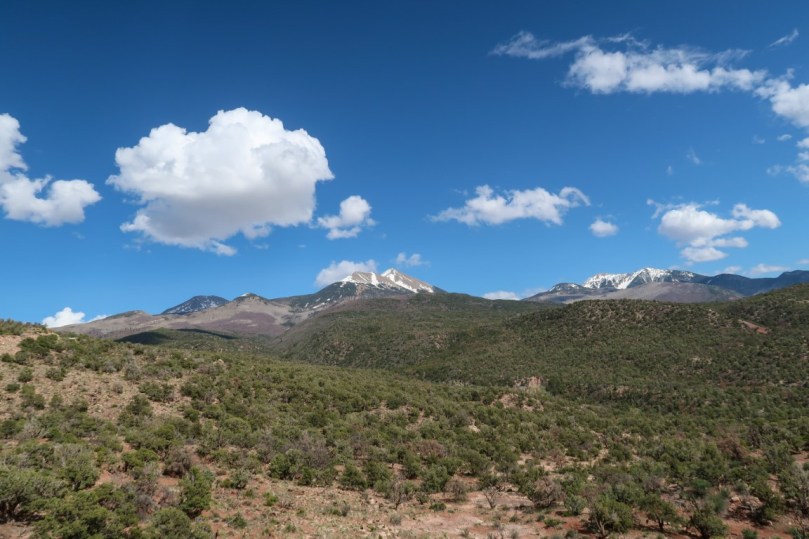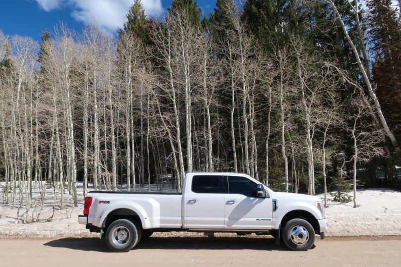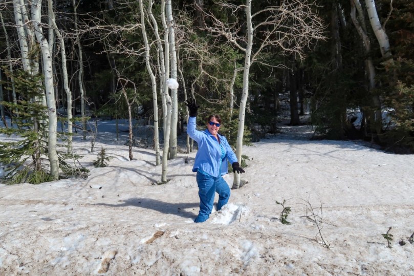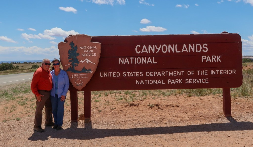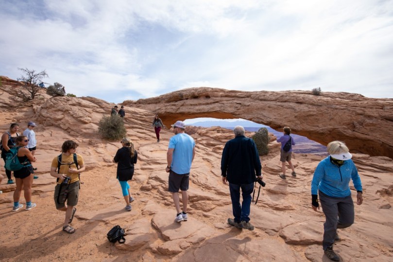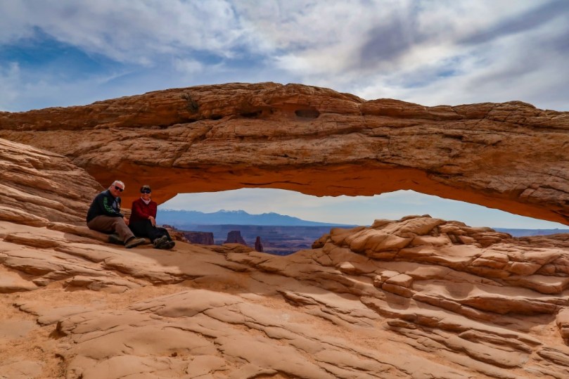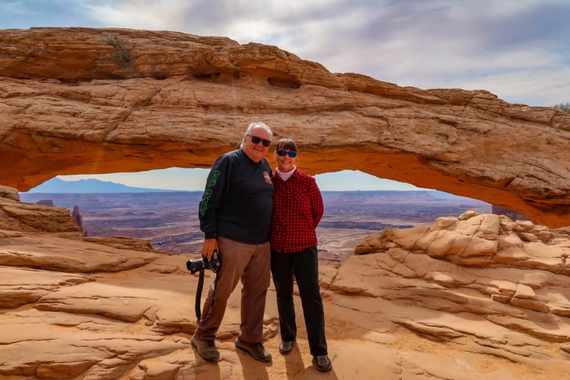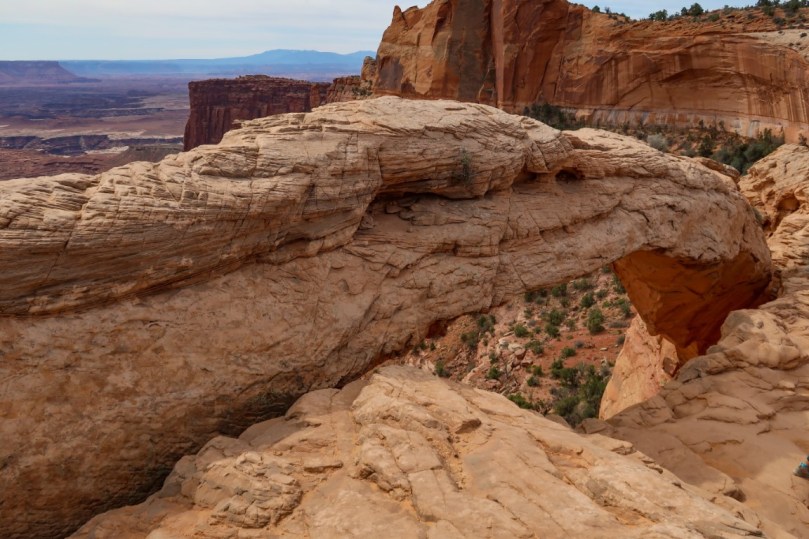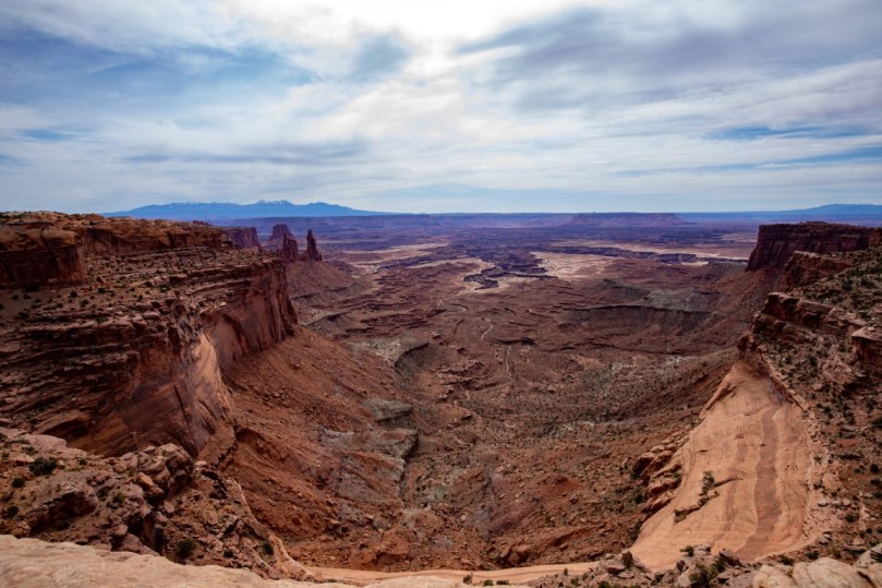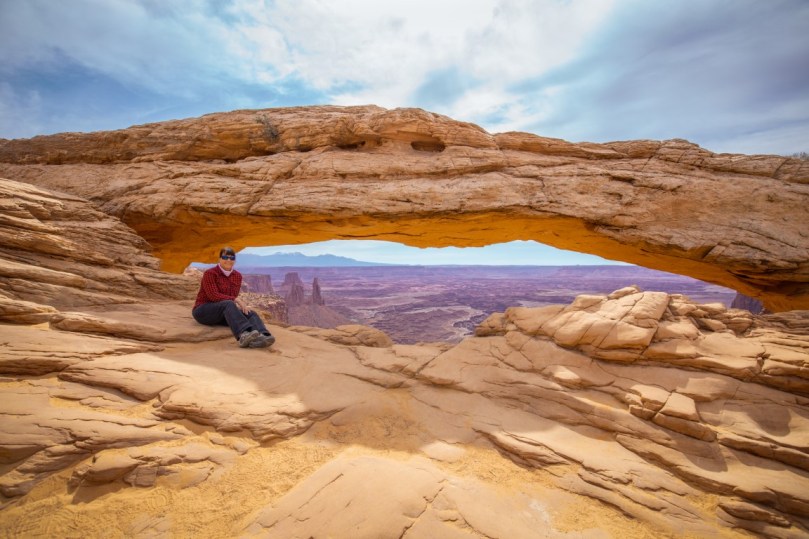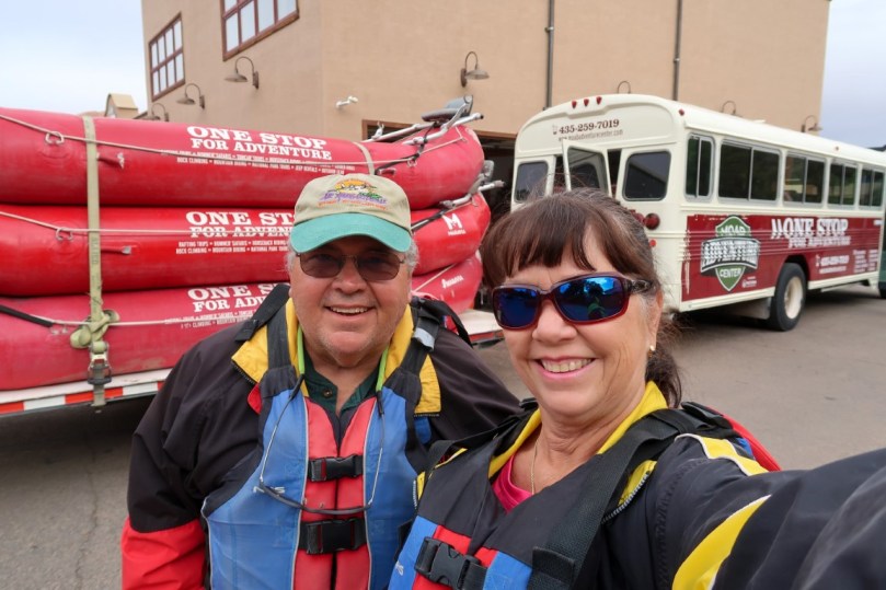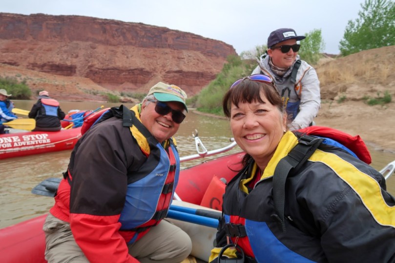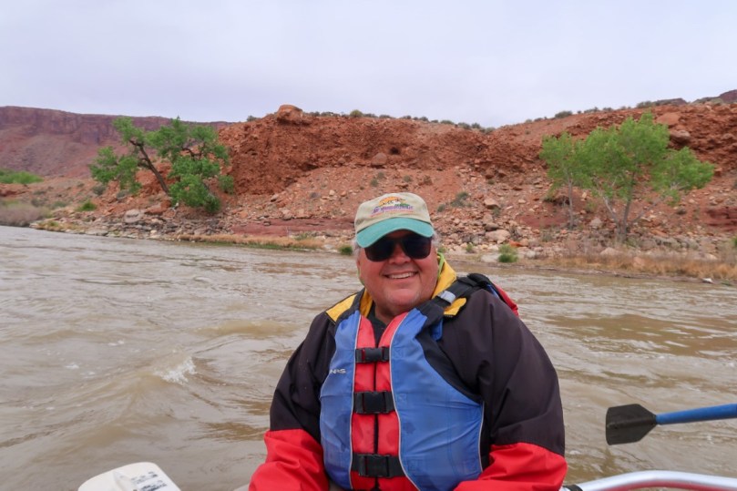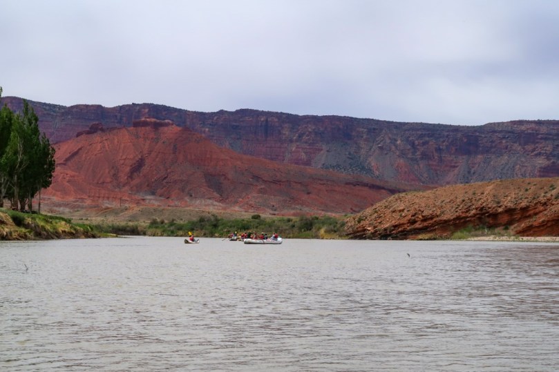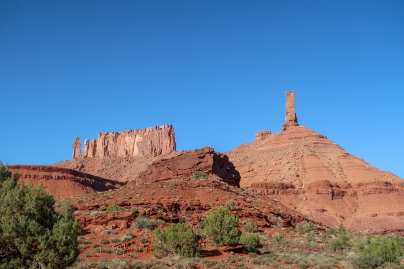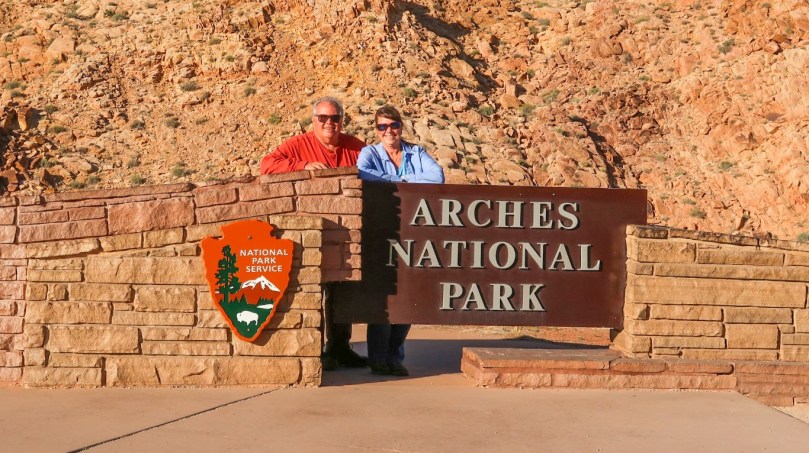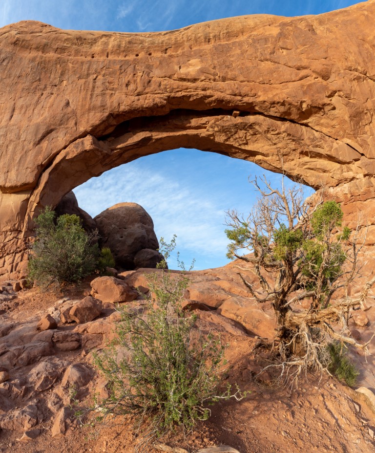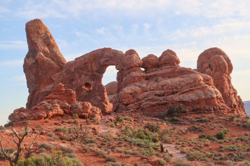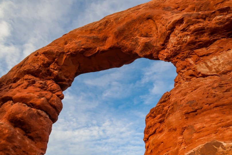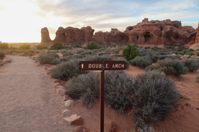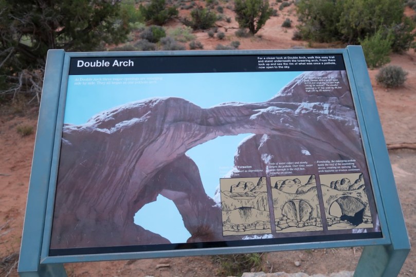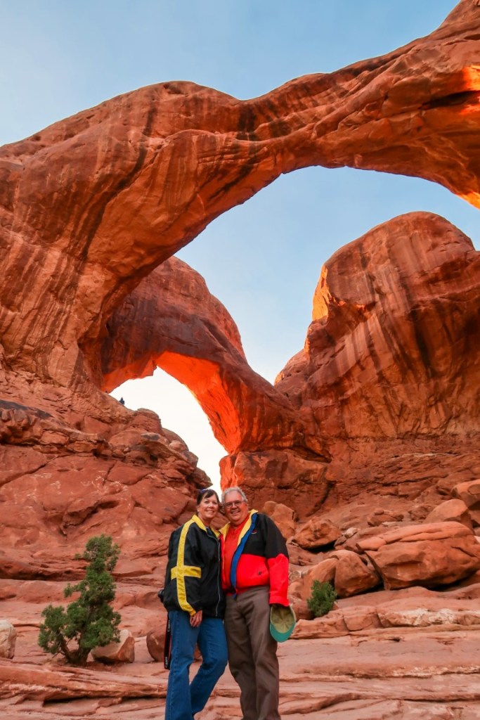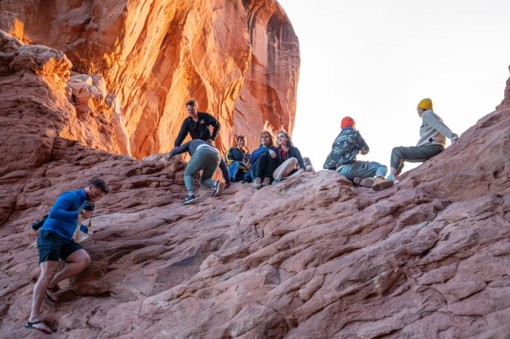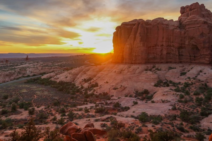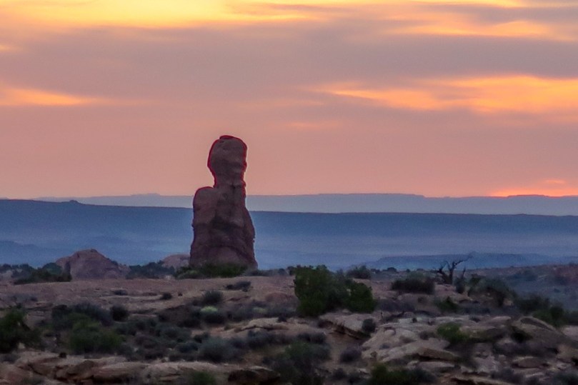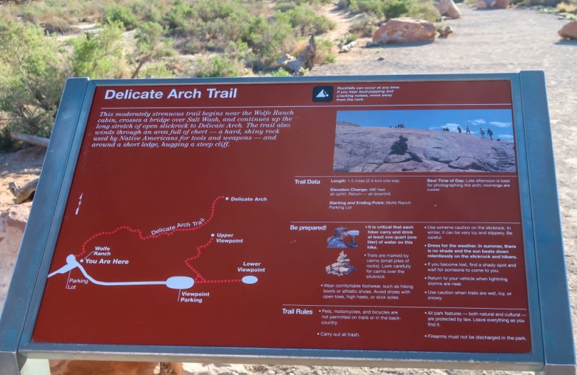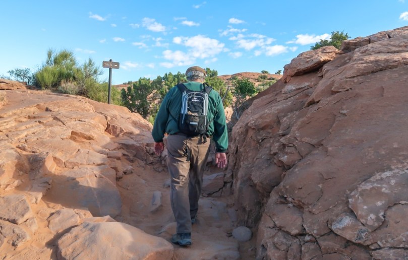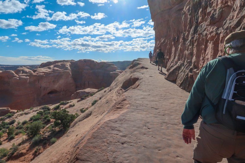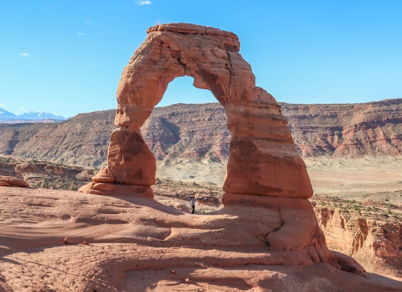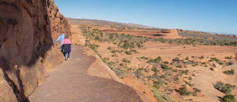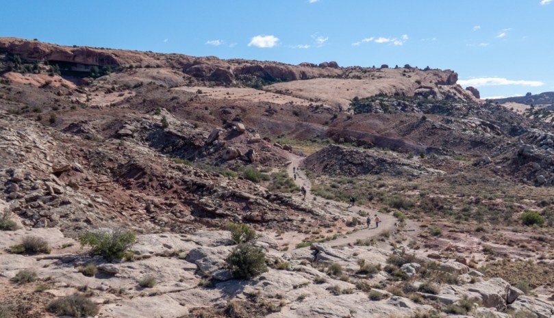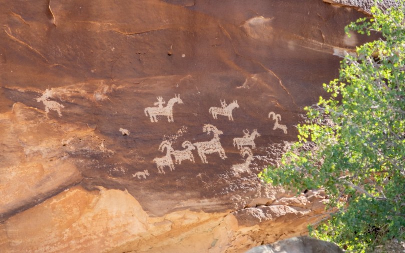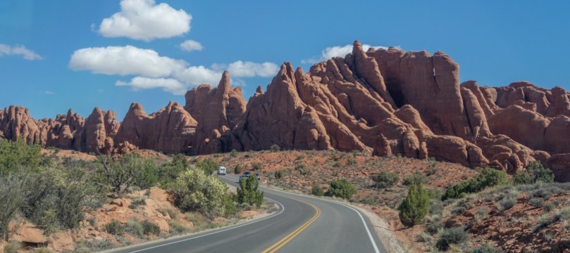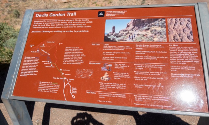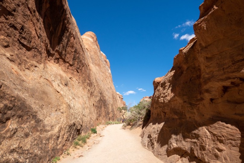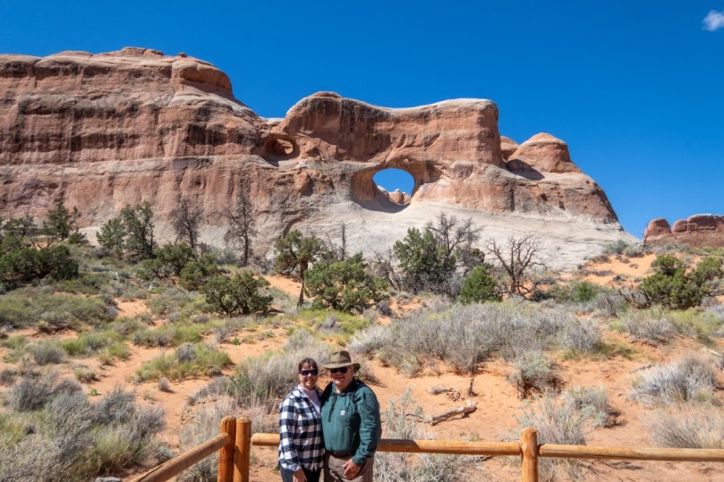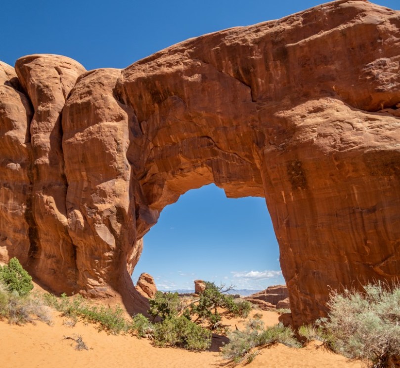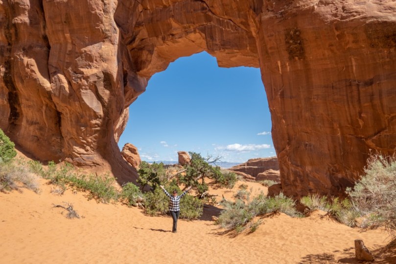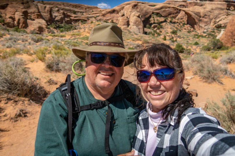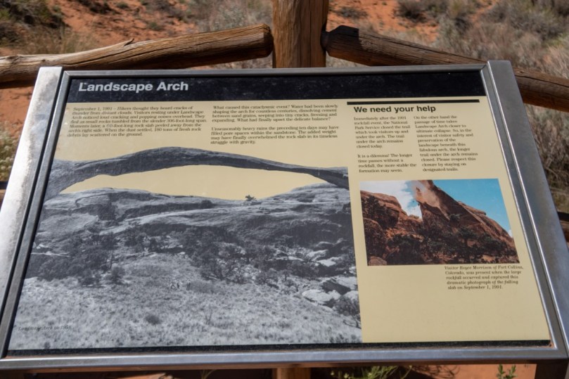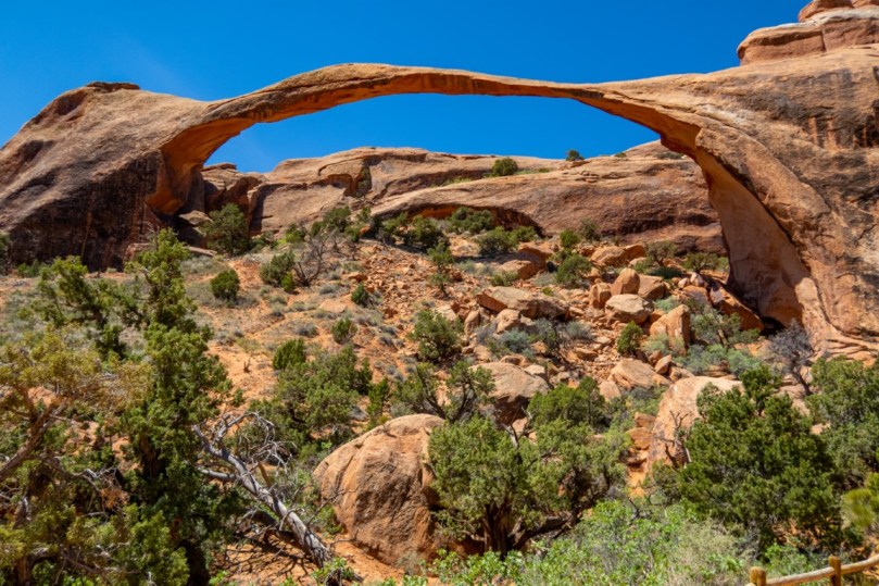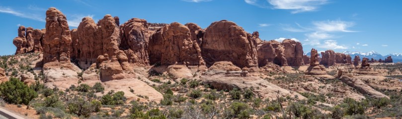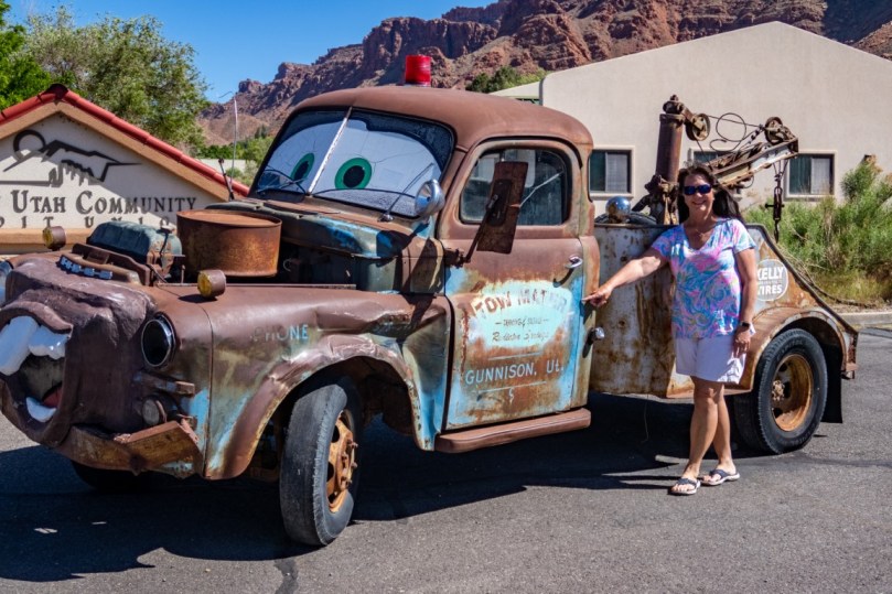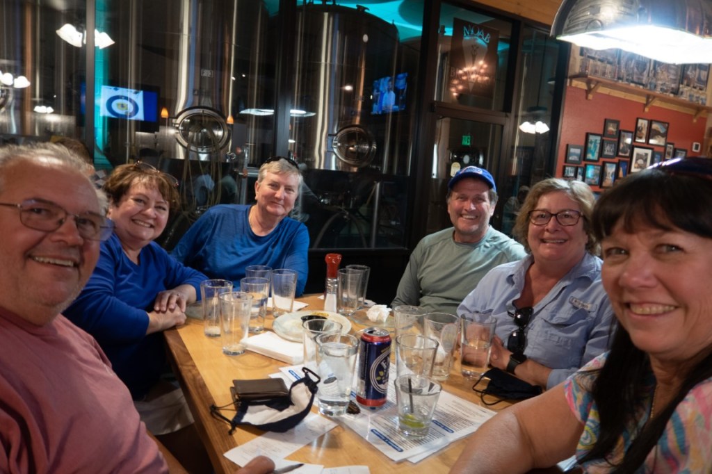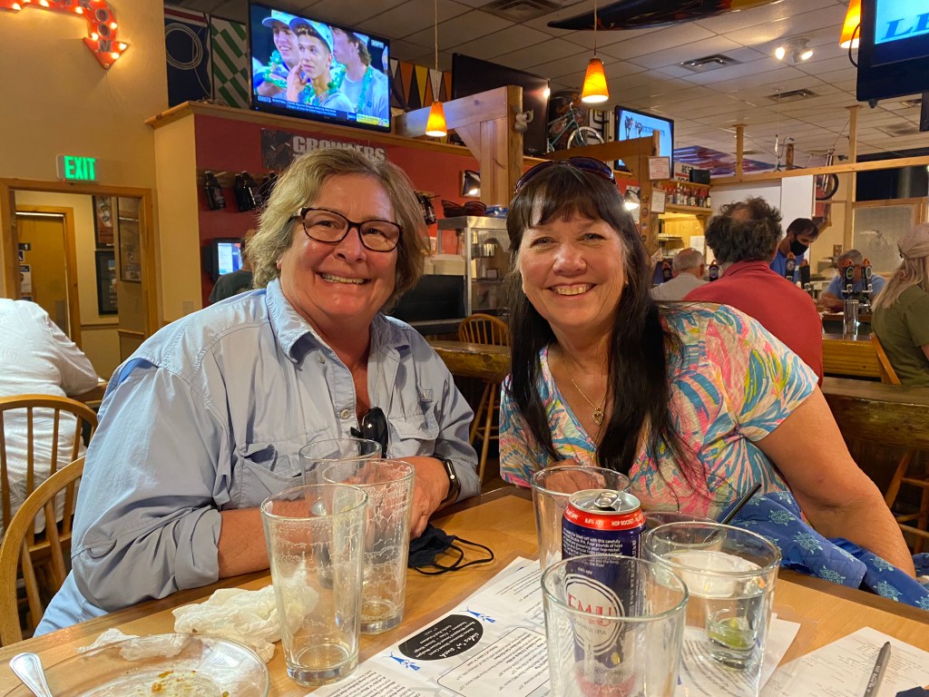

🎉 We spent 6 amazing days exploring this area & now have been to all the “Mighty 5”! We hiked, rock climbed, enjoyed wine tasting at the only winery, beer tasting at the only brewery & pub, drove up into the mountains to a pass that led us into snow, to an all day River rafting experience, shopping and walking the whole town, and then meeting up with a friend from my childhood! ***Moab is the largest city in eastern Utah. Known for its dramatic scenery. It’s a gateway to massive red rock formations in Arches National Park. Canyonlands National Park features mesas and buttes carved by the Green and Colorado rivers, plus Native American rock art. Dinosaur tracks can be found at sites like Bull Canyon Overlook and Copper Ridge. Interesting fact…. MOAB stands for Massive Ordinance Air Blast, which is the largest non-nuclear bomb ever dropped in battle. Moab attracts a lot of tourists annually, but according to a ranger this year they have been closing the National Parks late mornings due to capacity met for the past 65 days. The town is a popular base for mountain bikers and off roaming…ATV’s.*** Arches National Park is adjacent to the Colorado River, 4 miles north of Moab. More than 2,000 natural sandstone arches are located in the park, including the well-known Delicate Arch as well as a variety of unique geological resources and formations. The park contains the highest density of natural arches in the world. The park consists of 76,679 acres of high desert. The highest elevation in the park is 5,653 feet and the lowest elevation is 4,085 feet at the visitor center. The park receives an average of less than 10 inches of rain annually. 🌧 The area was originally named a National Monument on April 12, 1929, and was redesignated as a national park on November 12, 1971. Some of the Arches we hiked to are; Balanced Rock – a large balancing rock, the size of three school buses, Courthouse Towers- a collection of tall stone columns, Delicate Arch -a lone-standing arch which has become a symbol of Utah and the most recognized arch in the park (a very difficult, steep 3 mile trail but amazing view), Devils Garden- many arches and columns scattered along a ridge, Double Arch-two arches that share a common end (which I climbed up to the seat and watched the sunset….very steep climb and had to carefully scoot down on my butt)! Fiery Furnace- an area of maze-like narrow passages and tall rock columns, Landscape Arch – a very thin and long arch in the Devils Garden with a span of 306 feet, with only 11 feet thick at its center,(the longest arch in the park & world’s longest stone span) was spectacular to see, off this trail was a side trail to see Pine Tree & Tunnel Arches. and The Garden of Eden- acts as a birthing ground for many soon-to-be-arches, relatively speaking. You can see medium sized arches and tiny baby arches just starting to form all over this area. **** ***Canyonlands National Park preserves a colorful landscape eroded into numerous canyons, mesas, and buttes by the Colorado & Green Rivers. and their respective tributaries.The park is divided into four districts: the Island in the Sky, the Needles, the Maze, and the combined rivers—the Green and Colorado—which carved two large canyons into the Colorado Plateau…… We only did the Island in the Sky! It’s really a primitive desert atmosphere with a level Mesa. The district has many viewpoints overlooking the White Rim, a sandstone bench 1,200 feet below the Island, and the rivers, which are another 1,000 feet below the White Rim. Paradox salt beds & salt domes. Mesa Arch is a pothole arch on the edge of the Island in the Sky mesa and is a spectacular natural stone arch perched at the edge of a cliff with vast views of canyons!**Dead Horse Point State Park is a state park featuring a dramatic overlook of the Colorado River & Canyonlands NP. The park covers 5,362 acres of high desert at an altitude of 5,900 feet.The legend of the park is so named because of its use as a natural corral by cowboys in the late 1800’s chased wild mustangs onto the Point, using the neck to block off the way out and the horses often died of exposure from the heat & sun. Also Dead Horse Point State Park appeared in the final scene of the movie Thelma & Louise where they drove off the cliff! 😱 ***🍺 The Moab Brewery became our oasis in the desert. It’s Moab’s only microbrewery. Tim tried Dead Horse Ale, Rocket Bike Lager, Johnny’s American IPA, & Black Raven Stout. All 5%! ***The La Sal Mountains are along the border of Colorado southeast of Moab and north of the town of La Sal. The maximum elevation is at Mount Peale reaching 12,721 feet above sea level. The range contains three clusters of peaks separated by passes. The peaks span a distance of about 10 miles. The name of the range dates to Spanish times, when the Sierra La Sal (meaning the “Salt Mountains”) were a prominent landmark on the Old Spanish Trail between Santa Fe and Los Angeles. We took Geyser Pass up as far as we could go, due to heavy snow. I built my Florida girl snowman ☃️…..( yup needs work) & we saw cross-country skiers! Said they went up about 5 miles! ***What a busy 6 days! 🤦🏻♀️ Off to Salt Lake City!